Hurricane Rita was building up to an extremely dangerous Category 5 hurricane when the Moderate Resolution Imaging Spectroradiometer (MODIS) on NASAOs Terra satellite captured this image at 12:10 p.m., U.S. Eastern time on September 21, 2005. The storm bears the markings of a powerful hurricane: it is compact and circular with an open eye through which the deep blue waters of the Gulf of Mexico are visible. At the time this image was acquired, Rita had winds of 220 kilometers per hour (140 miles per hour)
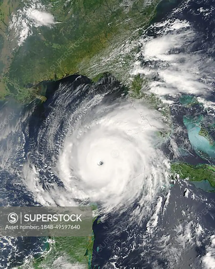
SuperStock offers millions of photos, videos, and stock assets to creatives around the world. This image of Hurricane Rita was building up to an extremely dangerous Category 5 hurricane when the Moderate Resolution Imaging Spectroradiometer (MODIS) on NASAOs Terra satellite captured this image at 12:10 p.m., U.S. Eastern time on September 21, 2005. The storm bears the markings of a powerful hurricane: it is compact and circular with an open eye through which the deep blue waters of the Gulf of Mexico are visible. At the time this image was acquired, Rita had winds of 220 kilometers per hour (140 miles per hour) by Phil Degginger/imageBROKER is available for licensing today.
Looking for a license?
Click here, and we'll help you find it! Questions? Just ask!
Click here, and we'll help you find it! Questions? Just ask!
DETAILS
Image Number: 1848-49597640Rights ManagedCredit Line:Phil Degginger/imageBROKER/SuperStockCollection:imageBROKER Contributor:Phil Degginger Model Release:NoProperty Release:NoResolution:3200×4000