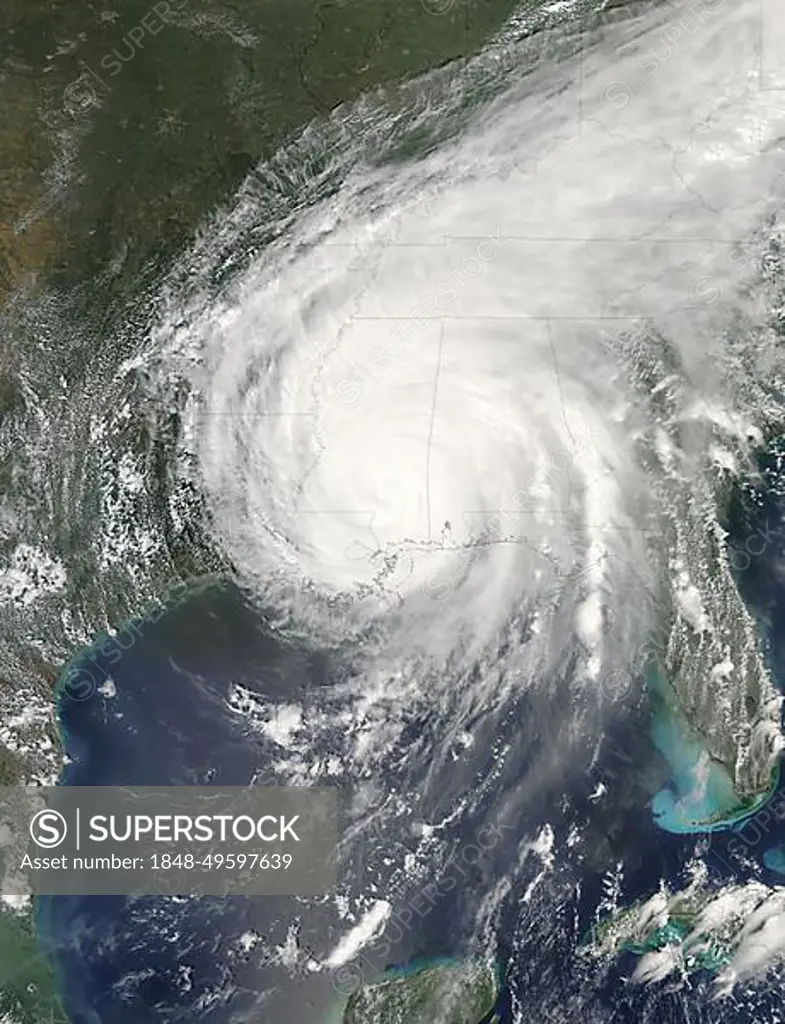
Hurricane Katrina was sprawled across all or part of 16 states at 2:15 p.m. CDT on August 29, 2005, when the Moderate Resolution Imaging Spectroradiometer (MODIS) on NASAOs Aqua satellite captured this image. After nearly eight hours over land, Katrina was still a Category 1 storm, with winds of 150 kilometers per hour (95 miles per hour) and stronger gusts. In this image, Katrina measures about 1, 260 kilometers (780 miles) from east to west and about the same distance from north to south across its cente
SuperStock offers millions of photos, videos, and stock assets to creatives around the world. This image of Hurricane Katrina was sprawled across all or part of 16 states at 2:15 p.m. CDT on August 29, 2005, when the Moderate Resolution Imaging Spectroradiometer (MODIS) on NASAOs Aqua satellite captured this image. After nearly eight hours over land, Katrina was still a Category 1 storm, with winds of 150 kilometers per hour (95 miles per hour) and stronger gusts. In this image, Katrina measures about 1, 260 kilometers (780 miles) from east to west and about the same distance from north to south across its cente by Phil Degginger/imageBROKER is available for licensing today.
Looking for a license?
Click here, and we'll help you find it! Questions? Just ask!
Click here, and we'll help you find it! Questions? Just ask!
DETAILS
Image Number: 1848-49597639Rights ManagedCredit Line:Phil Degginger/imageBROKER/SuperStockCollection:imageBROKER Contributor:Phil Degginger Model Release:NoProperty Release:NoResolution:3600×4700