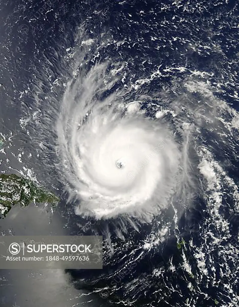
Hurricane Frances, the MODIS instrument aboard NASA's Aqua satellite captured this true-color image of Hurricane Frances on August 31, 2004 at 17:55 UTC (1:55 PM EDT) . At the time this image was taken Frances was located approximately 230 km (140 miles) north-northeast of San Juan, Puerto Rico and was moving towards the west near 26 km/hr (16 mph) . Maximum sustained winds were near 225 km/hr (140 mph) and the storm's minimum central pressure was down to 942 millibars
SuperStock offers millions of photos, videos, and stock assets to creatives around the world. This image of Hurricane Frances, the MODIS instrument aboard NASA's Aqua satellite captured this true-color image of Hurricane Frances on August 31, 2004 at 17:55 UTC (1:55 PM EDT) . At the time this image was taken Frances was located approximately 230 km (140 miles) north-northeast of San Juan, Puerto Rico and was moving towards the west near 26 km/hr (16 mph) . Maximum sustained winds were near 225 km/hr (140 mph) and the storm's minimum central pressure was down to 942 millibars by Phil Degginger/imageBROKER is available for licensing today.
Looking for a license?
Click here, and we'll help you find it! Questions? Just ask!
Click here, and we'll help you find it! Questions? Just ask!
DETAILS
Image Number: 1848-49597636Rights ManagedCredit Line:Phil Degginger/imageBROKER/SuperStockCollection:imageBROKER Contributor:Phil Degginger Model Release:NoProperty Release:NoResolution:2800×3600