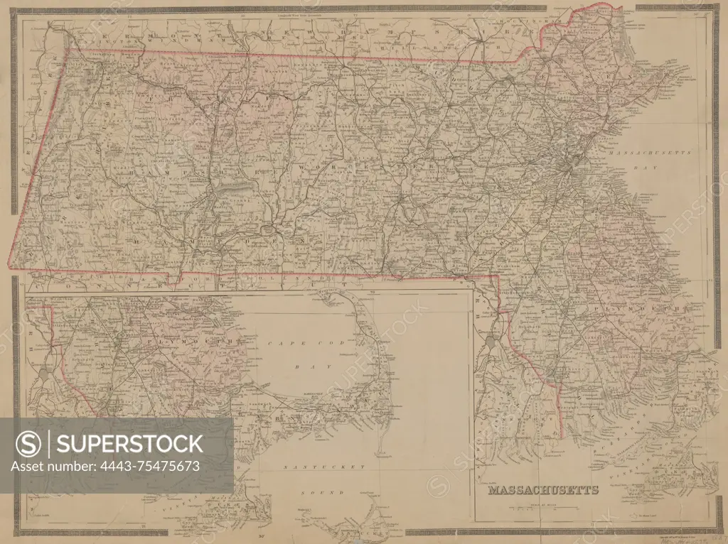
Hand-colored map of Massachusetts, created by Wm. M. Bradley & Bros. in 1887. The map measures 48 x 62 cm and is printed on a sheet that is 49 x 65 cm. It highlights the administrative and political divisions of the state
SuperStock offers millions of photos, videos, and stock assets to creatives around the world. This image of Hand-colored map of Massachusetts, created by Wm. M. Bradley & Bros. in 1887. The map measures 48 x 62 cm and is printed on a sheet that is 49 x 65 cm. It highlights the administrative and political divisions of the state by Artokoloro is available for licensing today.
Looking for a license?
Click here, and we'll help you find it! Questions? Just ask!
Click here, and we'll help you find it! Questions? Just ask!
DETAILS
Image Number: 4443-75475673Rights ManagedCredit Line:Artokoloro/SuperStockCollection:Artokoloro Model Release:NoProperty Release:NoResolution:5700×4268