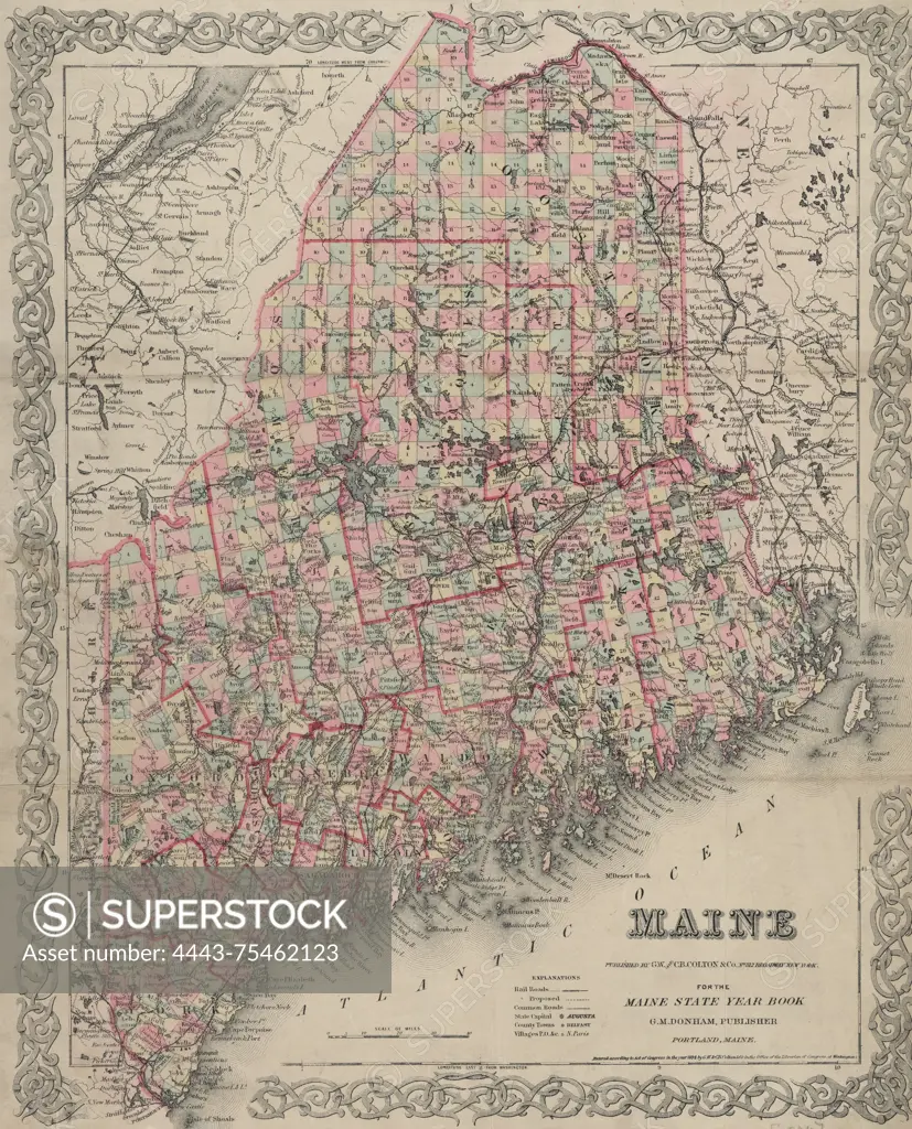
A hand-colored map of Maine, measuring 41 x 31 cm, published by G.W. & C.B. Colton & Co. in 1894. The map is displayed on a sheet measuring 43 x 35 cm and highlights the administrative and political divisions of the state
SuperStock offers millions of photos, videos, and stock assets to creatives around the world. This image of A hand-colored map of Maine, measuring 41 x 31 cm, published by G.W. & C.B. Colton & Co. in 1894. The map is displayed on a sheet measuring 43 x 35 cm and highlights the administrative and political divisions of the state by Artokoloro is available for licensing today.
Looking for a license?
Click here, and we'll help you find it! Questions? Just ask!
Click here, and we'll help you find it! Questions? Just ask!
DETAILS
Image Number: 4443-75462123Rights ManagedCredit Line:Artokoloro/SuperStockCollection:Artokoloro Model Release:NoProperty Release:NoResolution:4605×5700