A hand-colored map of Long Island, created by G.W. & C.B. Colton & Co. in 1866. The map outlines the administrative and political divisions of Long Island, New York. It measures 19 x 51 cm and is presented on a sheet of 27 x 60 cm, folded within a cover measuring 13 x 9 cm
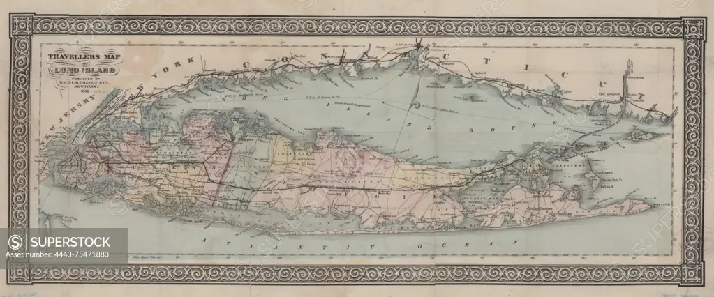
SuperStock offers millions of photos, videos, and stock assets to creatives around the world. This image of A hand-colored map of Long Island, created by G.W. & C.B. Colton & Co. in 1866. The map outlines the administrative and political divisions of Long Island, New York. It measures 19 x 51 cm and is presented on a sheet of 27 x 60 cm, folded within a cover measuring 13 x 9 cm by Artokoloro is available for licensing today.
Looking for a license?
Click here, and we'll help you find it! Questions? Just ask!
Click here, and we'll help you find it! Questions? Just ask!
DETAILS
Image Number: 4443-75471883Rights ManagedCredit Line:Artokoloro/SuperStockCollection:Artokoloro Model Release:NoProperty Release:NoResolution:7662×3189