A hand-colored map of Kentucky and Tennessee, published by A.J. Johnson in 1865. The map measures 39 x 55 cm on a sheet that is 46 x 67 cm. It features administrative and political divisions of both states. The publication took place in New York, N.Y
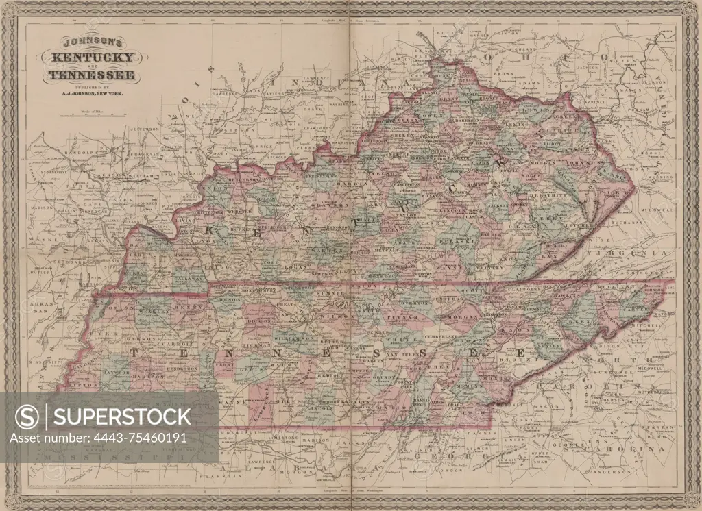
SuperStock offers millions of photos, videos, and stock assets to creatives around the world. This image of A hand-colored map of Kentucky and Tennessee, published by A.J. Johnson in 1865. The map measures 39 x 55 cm on a sheet that is 46 x 67 cm. It features administrative and political divisions of both states. The publication took place in New York, N.Y by Artokoloro is available for licensing today.
Looking for a license?
Click here, and we'll help you find it! Questions? Just ask!
Click here, and we'll help you find it! Questions? Just ask!
DETAILS
Image Number: 4443-75460191Rights ManagedCredit Line:Artokoloro/SuperStockCollection:Artokoloro Model Release:NoProperty Release:NoResolution:5700×4157