The Hague, Spanier, Elias, Netherlands, Suite of ten maps and plates of the reclamation of the Haarlemmermeer 1843-1860, Map VIII. Land division of the Haarlemmer Meer Polder, Map of the land division of the Haarlemmermeerpolder. On the right elevations of bridges and the crossings of the canals and roads. Inscriptions in Dutch and French. Part of a suite of ten plates of the draining of the Haarlemmermeer, 1843-1860., print, picture, map, prints, Frederik Muller Historieplaten, height 548 mm, width 730 mm, print maker, printmaker, 1852 - 1861, paper, papier, lithografie (technique), handkleuring, Nederlands, 1821-03-03 - 1863-04-27, printer, drukker
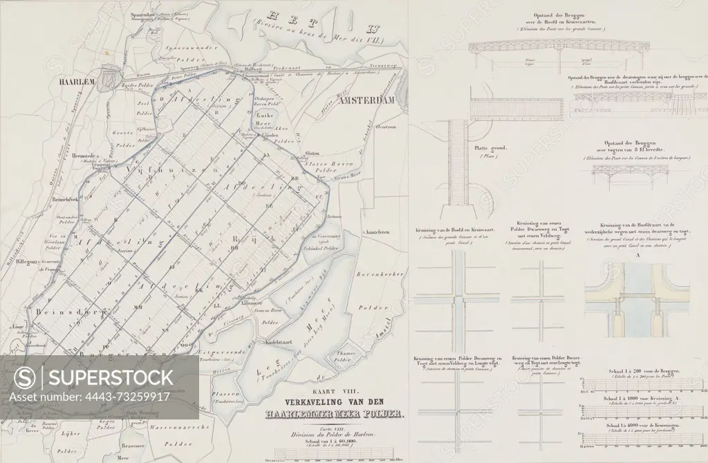
SuperStock offers millions of photos, videos, and stock assets to creatives around the world. This image of The Hague, Spanier, Elias, Netherlands, Suite of ten maps and plates of the reclamation of the Haarlemmermeer 1843-1860, Map VIII. Land division of the Haarlemmer Meer Polder, Map of the land division of the Haarlemmermeerpolder. On the right elevations of bridges and the crossings of the canals and roads. Inscriptions in Dutch and French. Part of a suite of ten plates of the draining of the Haarlemmermeer, 1843-1860., print, picture, map, prints, Frederik Muller Historieplaten, height 548 mm, width 730 mm, print maker, printmaker, 1852 - 1861, paper, papier, lithografie (technique), handkleuring, Nederlands, 1821-03-03 - 1863-04-27, printer, drukker by Artokoloro is available for licensing today.
Looking for a license?
Click here, and we'll help you find it! Questions? Just ask!
Click here, and we'll help you find it! Questions? Just ask!
DETAILS
Image Number: 4443-73259917Rights ManagedCredit Line:Artokoloro/SuperStockCollection:Artokoloro Model Release:NoProperty Release:NoResolution:5165×3381