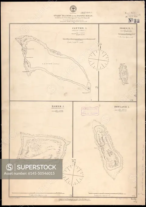
Guano islands in the Pacific Ocean , Kanton Kiribati, Maps, Rawaki Island Kiribati, Maps, Baker Island, Maps, Howland Island, Maps, Nautical charts, Kiribati, Kanton, Nautical charts, Kiribati, Rawaki Island, Nautical charts, Baker Island, Nautical charts, Howland Island Norman B. Leventhal Map Center Collection
SuperStock offers millions of photos, videos, and stock assets to creatives around the world. This image of Guano islands in the Pacific Ocean , Kanton Kiribati, Maps, Rawaki Island Kiribati, Maps, Baker Island, Maps, Howland Island, Maps, Nautical charts, Kiribati, Kanton, Nautical charts, Kiribati, Rawaki Island, Nautical charts, Baker Island, Nautical charts, Howland Island Norman B. Leventhal Map Center Collection by Piemags/PL Photography Limited is available for licensing today.
DETAILS
Image Number: 6145-50546015Royalty FreeCredit Line:Piemags/PL Photography Limited/SuperStockCollection:PL Photography Limited Contributor:Piemags Model Release:NoProperty Release:NoResolution:5190×7337