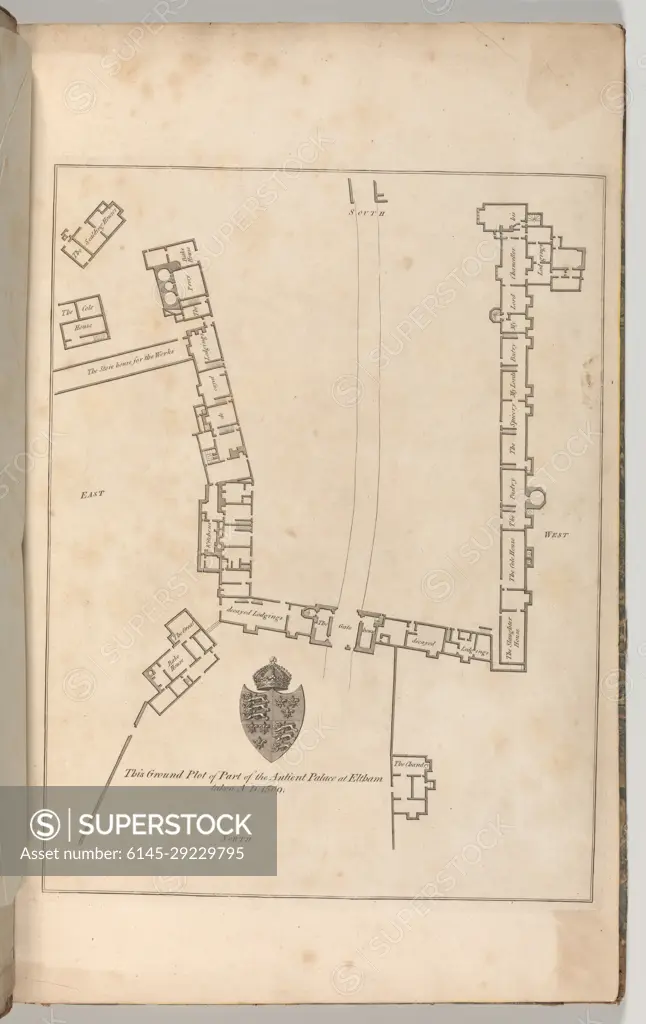
Ground plan of Ancient Palace at Eltham, from Edward Hasted's, The History and Topographical Survey of the County of Kent, vols. 1-3 1777 Drawn and etched by John Bayly Plate 9 from vol. I. See 2014.599.1-.30 for comments. Ground plan of Ancient Palace at Eltham, from Edward Hasted's, The History and Topographical Survey of the County of Kent, vols. 1-3. Drawn and etched by John Bayly (British, active 1755-82). 1777. Etching and engraving. Books
SuperStock offers millions of photos, videos, and stock assets to creatives around the world. This image of Ground plan of Ancient Palace at Eltham, from Edward Hasted's, The History and Topographical Survey of the County of Kent, vols. 1-3 1777 Drawn and etched by John Bayly Plate 9 from vol. I. See 2014.599.1-.30 for comments. Ground plan of Ancient Palace at Eltham, from Edward Hasted's, The History and Topographical Survey of the County of Kent, vols. 1-3. Drawn and etched by John Bayly (British, active 1755-82). 1777. Etching and engraving. Books by Piemags/PL Photography Limited is available for licensing today.
Looking for a license?
Click here, and we'll help you find it! Questions? Just ask!
Click here, and we'll help you find it! Questions? Just ask!
DETAILS
Image Number: 6145-29229795Royalty FreeCredit Line:Piemags/PL Photography Limited/SuperStockCollection:PL Photography Limited Contributor:Piemags Model Release:NoProperty Release:NoResolution:2413×3821