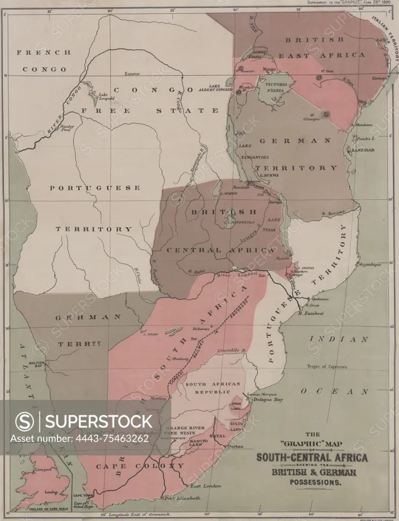
The Graphic map of South-Central Africa showing the British & German possessions, issued in 1890 by Maclure and MacDonald Lithographers. The map measures 54 x 40 cm and was published in London by Maclure & co
SuperStock offers millions of photos, videos, and stock assets to creatives around the world. This image of The Graphic map of South-Central Africa showing the British & German possessions, issued in 1890 by Maclure and MacDonald Lithographers. The map measures 54 x 40 cm and was published in London by Maclure & co by Artokoloro is available for licensing today.
Looking for a license?
Click here, and we'll help you find it! Questions? Just ask!
Click here, and we'll help you find it! Questions? Just ask!
DETAILS
Image Number: 4443-75463262Rights ManagedCredit Line:Artokoloro/SuperStockCollection:Artokoloro Model Release:NoProperty Release:NoResolution:4783×6236