Goulding's directory map of New York City, including the two recently annexed wards, engraved from the latest and most accurate surveys, issued in 1875 by Lawrence G. Goulding. The map features administrative and political divisions, local transit, and piers in New York City. It consists of 1 map in two sections, on 2 sheets, each measuring 66 x 72 cm
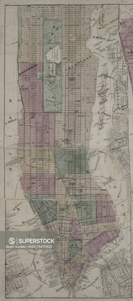
SuperStock offers millions of photos, videos, and stock assets to creatives around the world. This image of Goulding's directory map of New York City, including the two recently annexed wards, engraved from the latest and most accurate surveys, issued in 1875 by Lawrence G. Goulding. The map features administrative and political divisions, local transit, and piers in New York City. It consists of 1 map in two sections, on 2 sheets, each measuring 66 x 72 cm by Artokoloro is available for licensing today.
Looking for a license?
Click here, and we'll help you find it! Questions? Just ask!
Click here, and we'll help you find it! Questions? Just ask!
DETAILS
Image Number: 4443-75470439Rights ManagedCredit Line:Artokoloro/SuperStockCollection:Artokoloro Model Release:NoProperty Release:NoResolution:3291×7409