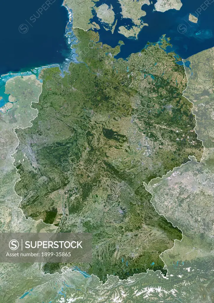
Germany, True Colour Satellite Image With Mask And Border. Germany, true colour satellite image with mask and border. This is the largest country in Europe in terms of population, at around 82 million (2006). To its north it borders the Jutland peninsula, which is part of Denmark. East of this is the Baltic Sea, west of it the North Sea. At centre left is the Netherlands, and below that Belgium and France. To its east are Poland (centre right) and the Czech Republic (lower right). The snow-cappe
SuperStock offers millions of photos, videos, and stock assets to creatives around the world. This image of Germany, True Colour Satellite Image With Mask And Border. Germany, true colour satellite image with mask and border. This is the largest country in Europe in terms of population, at around 82 million (2006). To its north it borders the Jutland peninsula, which is part of Denmark. East of this is the Baltic Sea, west of it the North Sea. At centre left is the Netherlands, and below that Belgium and France. To its east are Poland (centre right) and the Czech Republic (lower right). The snow-cappe by Universal Images is available for licensing today.
Looking for a license?
Click here, and we'll help you find it! Questions? Just ask!
Click here, and we'll help you find it! Questions? Just ask!
DETAILS
Image Number: 1899-35865Rights ManagedCredit Line:Universal Images/SuperStockCollection:Universal Images Model Release:NoProperty Release:NoResolution:3508×4961