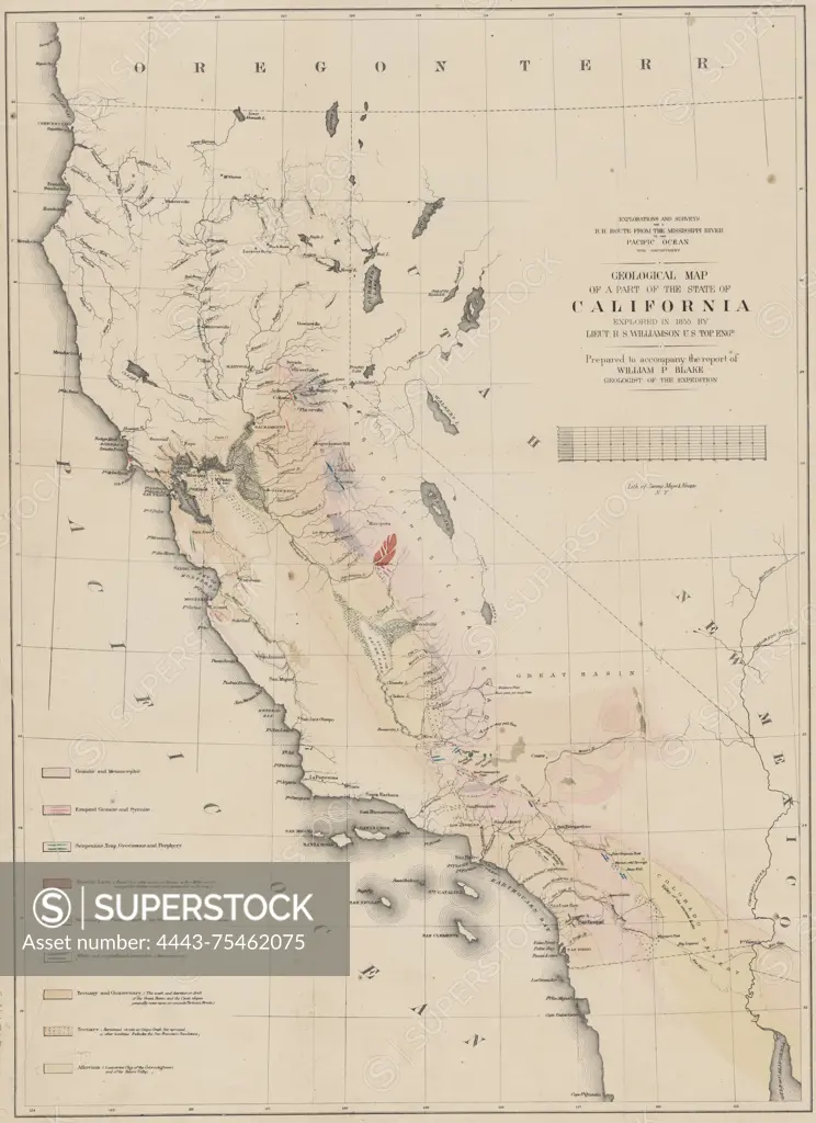
Geological map of a part of California explored in 1855 by Lieut. R.S. Williamson, U.S. Topographical Engineer. Prepared to accompany the report of William P. Blake, geologist of the expedition. Issued in 1855 by the War Department, U.S. Pacific Railroad Explorations & Surveys. The map is hand-colored and measures 57 x 41 cm. Place of publication Washington, D.C
SuperStock offers millions of photos, videos, and stock assets to creatives around the world. This image of Geological map of a part of California explored in 1855 by Lieut. R.S. Williamson, U.S. Topographical Engineer. Prepared to accompany the report of William P. Blake, geologist of the expedition. Issued in 1855 by the War Department, U.S. Pacific Railroad Explorations & Surveys. The map is hand-colored and measures 57 x 41 cm. Place of publication Washington, D.C by Artokoloro is available for licensing today.
Looking for a license?
Click here, and we'll help you find it! Questions? Just ask!
Click here, and we'll help you find it! Questions? Just ask!
DETAILS
Image Number: 4443-75462075Rights ManagedCredit Line:Artokoloro/SuperStockCollection:Artokoloro Model Release:NoProperty Release:NoResolution:4143×5700