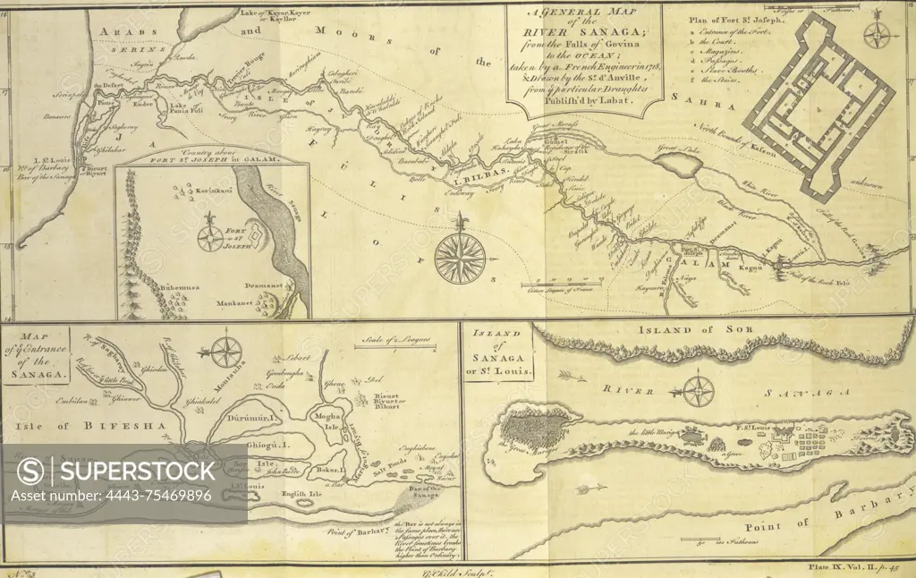
A general map of the River Sanaga, from the falls of Govina to the ocean; plan of Fort St. Joseph; country about Fort St. Joseph in Galam; map of the entrance of the Sanaga; island of Sanaga or St. Louis. Created by Thomas Astley, 1745 - 1747., London; Publisher, Printed for T. Astley, 1745 - 1747; Engravings
SuperStock offers millions of photos, videos, and stock assets to creatives around the world. This image of A general map of the River Sanaga, from the falls of Govina to the ocean; plan of Fort St. Joseph; country about Fort St. Joseph in Galam; map of the entrance of the Sanaga; island of Sanaga or St. Louis. Created by Thomas Astley, 1745 - 1747., London; Publisher, Printed for T. Astley, 1745 - 1747; Engravings by Artokoloro is available for licensing today.
Looking for a license?
Click here, and we'll help you find it! Questions? Just ask!
Click here, and we'll help you find it! Questions? Just ask!
DETAILS
Image Number: 4443-75469896Rights ManagedCredit Line:Artokoloro/SuperStockCollection:Artokoloro Model Release:NoProperty Release:NoResolution:3614×2282