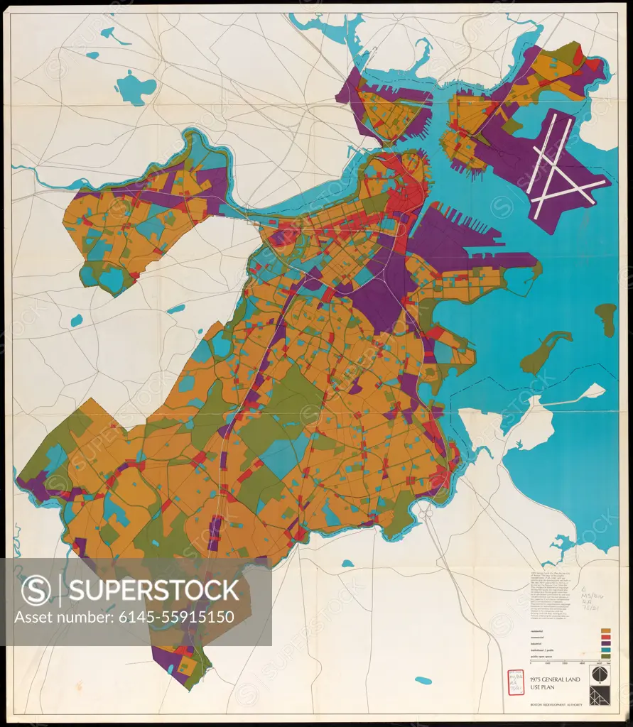
1975 general land use plan. "Graphic representation of all major land use policies and recommendations set forth in the 1965/1975 general plan for the city of Boston and the regional core." Indicates residential, commercial, industrial, institutional/public, and public open space.... , Massachusetts , Suffolk ,county , Boston
SuperStock offers millions of photos, videos, and stock assets to creatives around the world. This image of 1975 general land use plan. "Graphic representation of all major land use policies and recommendations set forth in the 1965/1975 general plan for the city of Boston and the regional core." Indicates residential, commercial, industrial, institutional/public, and public open space.... , Massachusetts , Suffolk ,county , Boston by Piemags/PL Photography Limited is available for licensing today.
Looking for a license?
Click here, and we'll help you find it! Questions? Just ask!
Click here, and we'll help you find it! Questions? Just ask!
DETAILS
Image Number: 6145-55915150Royalty FreeCredit Line:Piemags/PL Photography Limited/SuperStockCollection:PL Photography Limited Story:Transit Maps of BostonContributor:Piemags Model Release:NoProperty Release:NoResolution:8660×9952