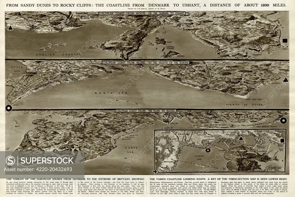
From sandy dunes to rocky cliffs: the coastline from Denmark to Ushant (Brittany), a distance of about 1200 miles. The terrain of the European shores from Denmark to the extreme of Brittany, showing the varied coastline looking south. A key of the three-section map can be seen in the lower right. Date: 1944
SuperStock offers millions of photos, videos, and stock assets to creatives around the world. This image of Explore the Scenic Coastline from Denmark to Ushant: A Detailed Vintage Map Charting 1200 Miles of Europe's Coastal Beauty. by Illustrated London News Ltd/Mary Evans Picture Library/Pantheon is available for licensing today.
Looking for a license?
Click here, and we'll help you find it! Questions? Just ask!
Click here, and we'll help you find it! Questions? Just ask!
DETAILS
Image Number: 4220-20432693Rights ManagedCredit Line:Illustrated London News Ltd/Mary Evans Picture Library/Pantheon/SuperStockCollection:Mary Evans Picture Library Contributor:Illustrated London News Ltd Model Release:NoProperty Release:NoResolution:6615×4416