The figurative map of Adriaen Block, created in 1614, depicts the Middle Atlantic States and New England, including Manhattan (New York, N.Y.). It is a drawing measuring 66 x 49 cm, rendered in watercolors
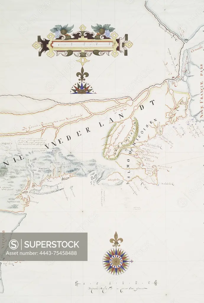
SuperStock offers millions of photos, videos, and stock assets to creatives around the world. This image of The figurative map of Adriaen Block, created in 1614, depicts the Middle Atlantic States and New England, including Manhattan (New York, N.Y.). It is a drawing measuring 66 x 49 cm, rendered in watercolors by Artokoloro is available for licensing today.
Looking for a license?
Click here, and we'll help you find it! Questions? Just ask!
Click here, and we'll help you find it! Questions? Just ask!
DETAILS
Image Number: 4443-75458488Rights ManagedCredit Line:Artokoloro/SuperStockCollection:Artokoloro Model Release:NoProperty Release:NoResolution:2814×4173