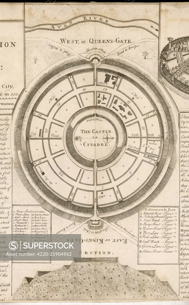
An 'exact plan' and section of the castle of Old Sarum, above Salisbury Plain, showing the East or King's Gate, the West, or Queen's Gate and its proximity to the River Avon. Date: before 553 AD
SuperStock offers millions of photos, videos, and stock assets to creatives around the world. This image of Explore the Intricacies of Medieval Fortification: Detailed Vintage Map of Ancient Castle Layout and City Walls by Mary Evans Picture Library/Pantheon is available for licensing today.
Looking for a license?
Click here, and we'll help you find it! Questions? Just ask!
Click here, and we'll help you find it! Questions? Just ask!
DETAILS
Image Number: 4220-21904962Rights ManagedCredit Line:Mary Evans Picture Library/Pantheon/SuperStockCollection:Mary Evans Picture Library Model Release:NoProperty Release:NoResolution:2976×4787