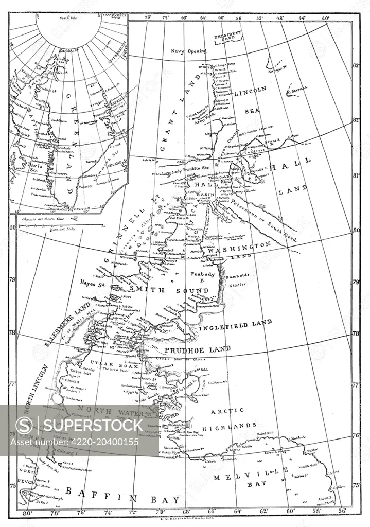
Engraving showing a map of Smith Sound and Greenland, as it was known in May 1875. Much of the map is erroneous or missing in detail, as the Arctic area had been little visited by Europeans up to that time. In the summer of 1875 the British Admiralty sent Captain George Nares with two ships, HMS 'Alert' and HMS 'Discovery', to make an attempt to reach the North Pole via Smith Sound. The attempt was unsuccessful, but a new 'furthest North' record was set, the coasts of Greenland and Elle
SuperStock offers millions of photos, videos, and stock assets to creatives around the world. This image of Antique Map of Canadian Arctic Archipelago - Explore Historical North America Geography by Illustrated London News Ltd/Mary Evans Picture Library/Pantheon is available for licensing today.
Looking for a license?
Click here, and we'll help you find it! Questions? Just ask!
Click here, and we'll help you find it! Questions? Just ask!
DETAILS
Image Number: 4220-20400155Rights ManagedCredit Line:Illustrated London News Ltd/Mary Evans Picture Library/Pantheon/SuperStockCollection:Mary Evans Picture Library Contributor:Illustrated London News Ltd Model Release:NoProperty Release:NoResolution:4133×5879