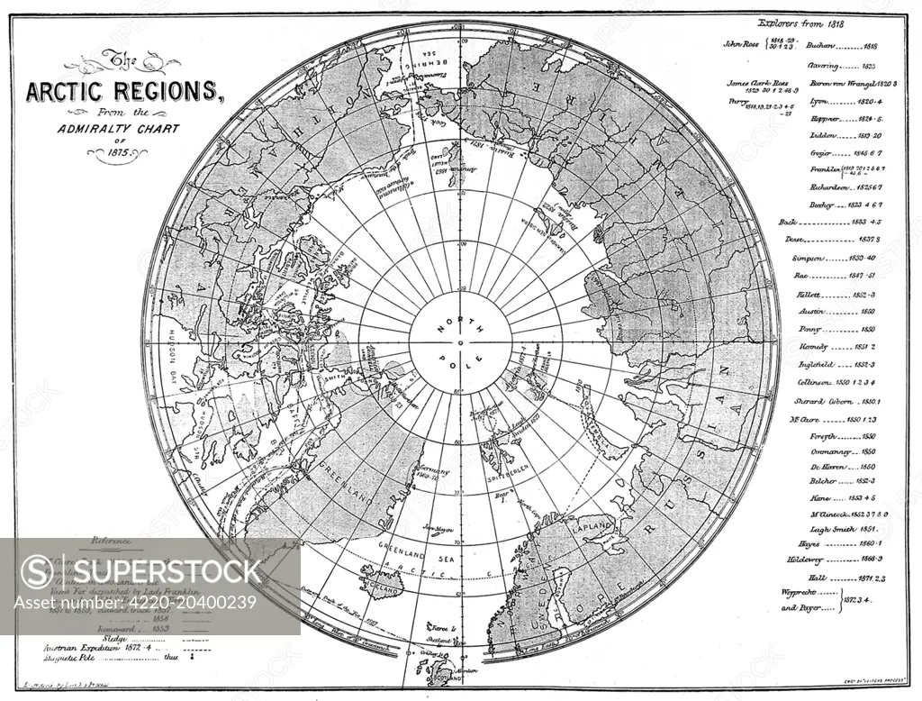
Engraving showing a map of the Arctic region, produced by the British Admiralty in 1875. Although mostly complete, the blank area around the North Pole shows the area that had not yet been visited and charted by explorers. Date: 1875
SuperStock offers millions of photos, videos, and stock assets to creatives around the world. This image of Explore Historic Arctic Regions with This Detailed 1875 Admiralty Chart Map - A Glimpse into Polar Exploration History. by Illustrated London News Ltd/Mary Evans Picture Library/Pantheon is available for licensing today.
Looking for a license?
Click here, and we'll help you find it! Questions? Just ask!
Click here, and we'll help you find it! Questions? Just ask!
DETAILS
Image Number: 4220-20400239Rights ManagedCredit Line:Illustrated London News Ltd/Mary Evans Picture Library/Pantheon/SuperStockCollection:Mary Evans Picture Library Contributor:Illustrated London News Ltd Model Release:NoProperty Release:NoResolution:5642×4292