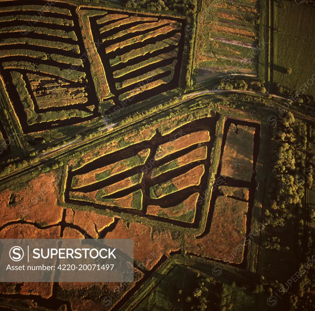
England - Aerial view, Peat Extraction, Westhay Moor. near Glastonbury, Somerset. At the beginning of the 20th century mechanised diggers were used to create machine cut trenches. The peat was then stacked in blocks to dry. It still happens today, but is strictly limited. The geometrical patterns formed by the dark peat and gleaming water, remain a characteristic symbol of the Levels around the River Brue.
SuperStock offers millions of photos, videos, and stock assets to creatives around the world. This image of Aerial View of Ancient Irish Boglands: Explore Historical Landscape Patterns for Unique Archaeological Insights. by Dae Sasitornanth/Mary Evans Picture Library/Pantheon is available for licensing today.
Looking for a license?
Click here, and we'll help you find it! Questions? Just ask!
Click here, and we'll help you find it! Questions? Just ask!
DETAILS
Image Number: 4220-20071497Rights ManagedCredit Line:Dae Sasitornanth/Mary Evans Picture Library/Pantheon/SuperStockCollection:Mary Evans Picture Library Contributor:Dae Sasitornanth Model Release:NoProperty Release:NoResolution:6948×6863