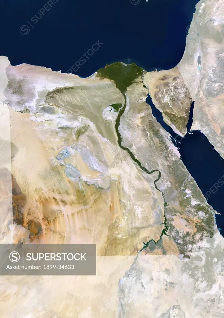
Egypt, True Colour Satellite Image With Mask. Egypt, true colour satellite image with mask. North is at top. In the center of the image is the Nile Delta, its lush vegetation following the path of the river. To the east of the Nile is the Gulf of Suez, which runs down the western side of the Sinai Peninsula. This image was compiled from data acquired by LANDSAT 5 & 7 satellites.
SuperStock offers millions of photos, videos, and stock assets to creatives around the world. This image of Egypt, True Colour Satellite Image With Mask. Egypt, true colour satellite image with mask. North is at top. In the center of the image is the Nile Delta, its lush vegetation following the path of the river. To the east of the Nile is the Gulf of Suez, which runs down the western side of the Sinai Peninsula. This image was compiled from data acquired by LANDSAT 5 & 7 satellites. by Universal Images is available for licensing today.
Looking for a license?
Click here, and we'll help you find it! Questions? Just ask!
Click here, and we'll help you find it! Questions? Just ask!
DETAILS
Image Number: 1899-34633Rights ManagedCredit Line:Universal Images/SuperStockCollection:Universal Images Model Release:NoProperty Release:NoResolution:3508×4961