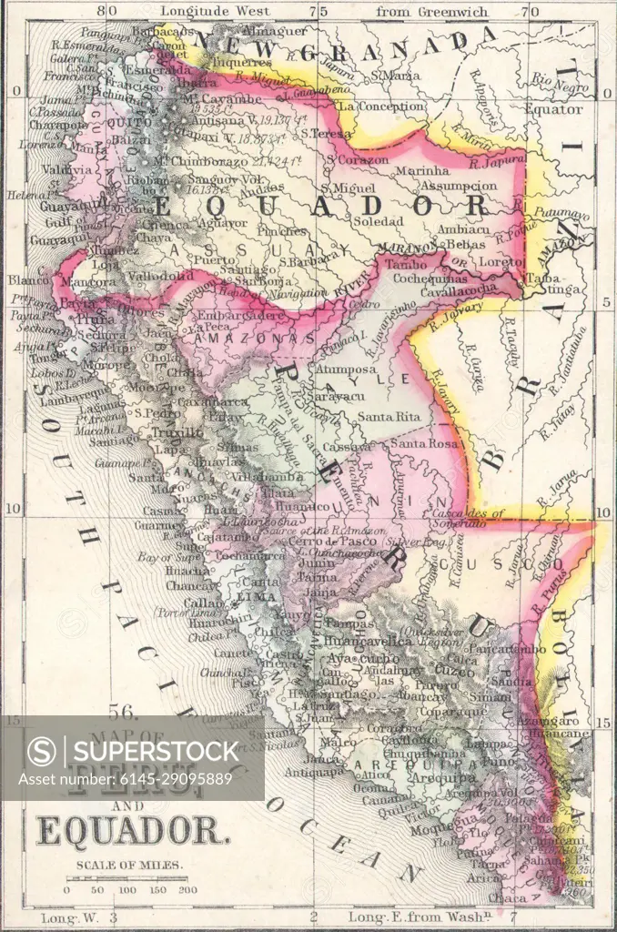
Ecuador and Peru detail, 1864 Mitchell Map of Peru, Equador (Ecuador), Argentina, Columbia and Venezuela
SuperStock offers millions of photos, videos, and stock assets to creatives around the world. This image of Explore Historical Boundaries: Antique Map of Peru and Ecuador - A Glimpse into 19th Century Geography and Borders. by Piemags/PL Photography Limited is available for licensing today.
Looking for a license?
Click here, and we'll help you find it! Questions? Just ask!
Click here, and we'll help you find it! Questions? Just ask!
DETAILS
Image Number: 6145-29095889Royalty FreeCredit Line:Piemags/PL Photography Limited/SuperStockCollection: