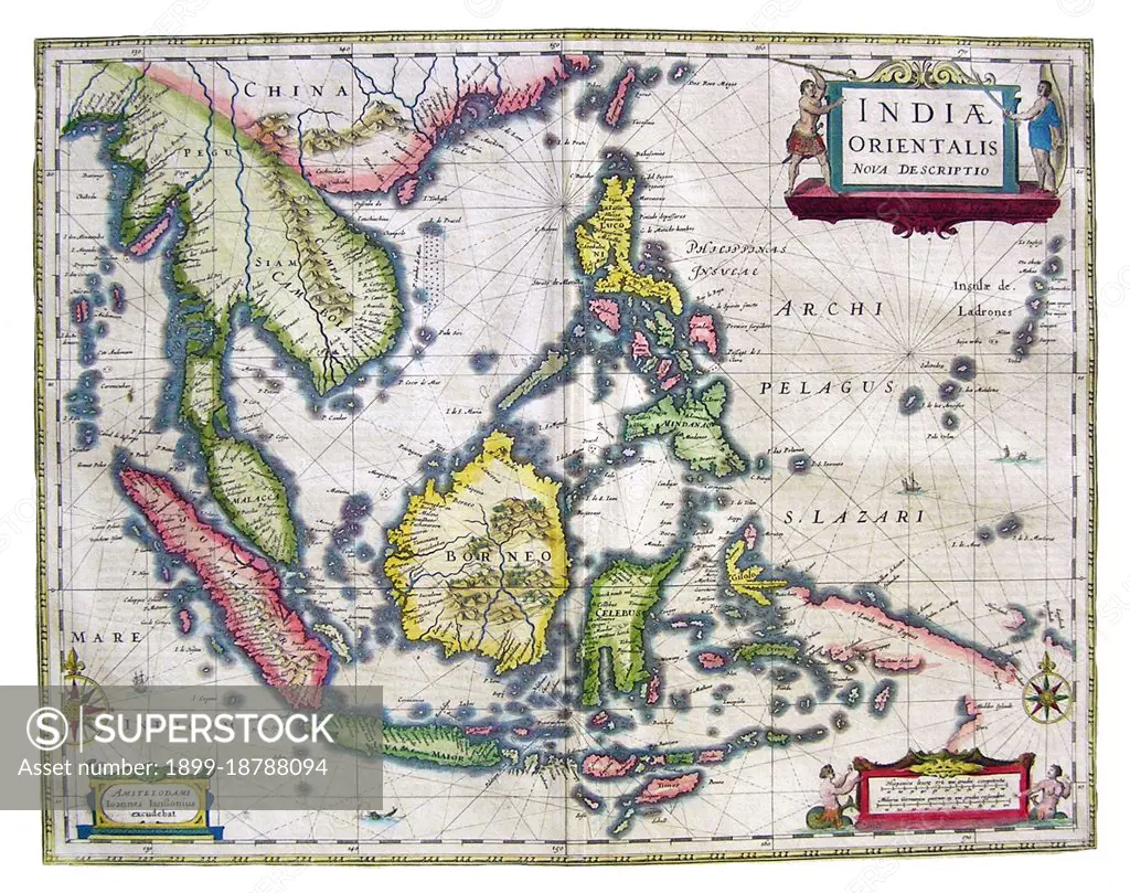
An early map of Southeast Asia showing the extent and limitations of European knowledge of the region. While the larger islands of Indonesia are charted with some accuracy, the southern coast of Java and the Lesser Sundas are charted only in general outline, and New Guinea is particularly incomplete. In all areas we see coastal features and settlements, but there is little interior detail. The Philippines are well described, and the Mariana Islands (Ladrones) are given undue size and prominence.
SuperStock offers millions of photos, videos, and stock assets to creatives around the world. This image of An early map of Southeast Asia showing the extent and limitations of European knowledge of the region. While the larger islands of Indonesia are charted with some accuracy, the southern coast of Java and the Lesser Sundas are charted only in general outline, and New Guinea is particularly incomplete. In all areas we see coastal features and settlements, but there is little interior detail. The Philippines are well described, and the Mariana Islands (Ladrones) are given undue size and prominence. by Pictures From History/Universal Images is available for licensing today.
Looking for a license?
Click here, and we'll help you find it! Questions? Just ask!
Click here, and we'll help you find it! Questions? Just ask!
DETAILS
Image Number: 1899-18788094Rights ManagedCredit Line:Pictures From History/Universal Images/SuperStockCollection:Universal Images Contributor:Pictures From History Model Release:NoProperty Release:NoResolution:4700×3716