The Dunhuang map or Dunhuang Star map is one of the first known graphical representations of stars from ancient Chinese astronomy, dated to the Tang Dynasty (618-907). Before this map, much of the star information mentioned in historical Chinese texts had been questioned. The map provides a graphical verification of the star observations, and are part of a series of pictures on one of the Dunhuang manuscripts. The Dunhuang Star map is to date the world's oldest complete preserved star atlas.
This image has restrictions in , but still may be available. Get in touch for more details.
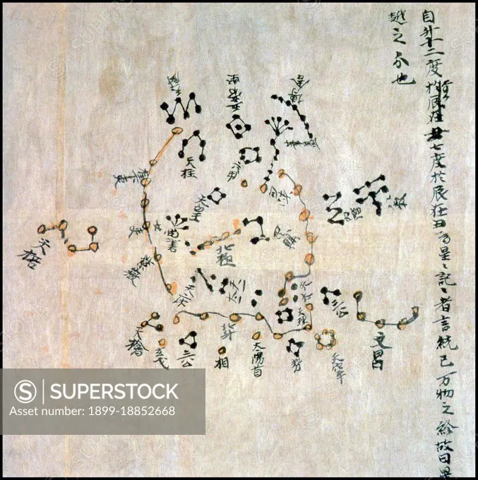
SuperStock offers millions of photos, videos, and stock assets to creatives around the world. This image of The Dunhuang map or Dunhuang Star map is one of the first known graphical representations of stars from ancient Chinese astronomy, dated to the Tang Dynasty (618-907). Before this map, much of the star information mentioned in historical Chinese texts had been questioned. The map provides a graphical verification of the star observations, and are part of a series of pictures on one of the Dunhuang manuscripts. The Dunhuang Star map is to date the world's oldest complete preserved star atlas. by Pictures from History/Universal Images is available for licensing today.
DETAILS
Image Number: 1899-18852668Rights ManagedCredit Line:Pictures from History/Universal Images/SuperStockCollection:Universal Images Contributor:Pictures from History Model Release:NoProperty Release:NoResolution:4247×4263