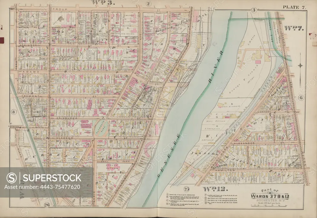
Double Page Plate No. 7 Map of Rochester, bounded by Troup St., South Ave., Hamilton Ave., Olean St., and Ford St., issued in 1888 by E. Robinson, Rochester, New York. The map illustrates real property in Rochester, New York State
SuperStock offers millions of photos, videos, and stock assets to creatives around the world. This image of Double Page Plate No. 7 Map of Rochester, bounded by Troup St., South Ave., Hamilton Ave., Olean St., and Ford St., issued in 1888 by E. Robinson, Rochester, New York. The map illustrates real property in Rochester, New York State by Artokoloro is available for licensing today.
Looking for a license?
Click here, and we'll help you find it! Questions? Just ask!
Click here, and we'll help you find it! Questions? Just ask!
DETAILS
Image Number: 4443-75477620Rights ManagedCredit Line:Artokoloro/SuperStockCollection:Artokoloro Model Release:NoProperty Release:NoResolution:6920×4758