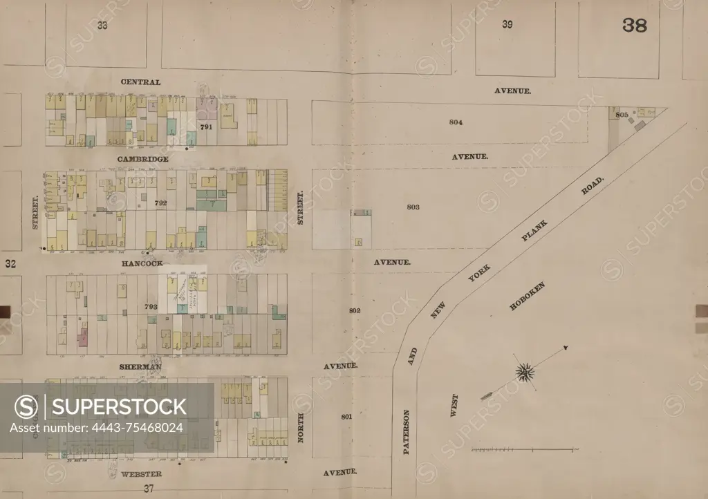
A double page plate map of Jersey City, created in 1873 by the firm Spielmann & Brush. The map is bounded by Central Avenue, Paterson and New York Plank Road, Webster Avenue, and Congress Street. It was published in Hoboken, New Jersey, and is related to fire insurance in Jersey City, New Jersey
SuperStock offers millions of photos, videos, and stock assets to creatives around the world. This image of A double page plate map of Jersey City, created in 1873 by the firm Spielmann & Brush. The map is bounded by Central Avenue, Paterson and New York Plank Road, Webster Avenue, and Congress Street. It was published in Hoboken, New Jersey, and is related to fire insurance in Jersey City, New Jersey by Artokoloro is available for licensing today.
Looking for a license?
Click here, and we'll help you find it! Questions? Just ask!
Click here, and we'll help you find it! Questions? Just ask!
DETAILS
Image Number: 4443-75468024Rights ManagedCredit Line:Artokoloro/SuperStockCollection:Artokoloro Model Release:NoProperty Release:NoResolution:5700×4019