Double Page Plate No. 2, issued in 1898 by E.B. Hyde & Co., presents a detailed land map of a section in Brooklyn, New York City. The map is bounded by Montgomery Street, Utica Avenue, Crown Street, Ford Street, East New York Avenue, Howard Avenue, Clarkson Avenue, Remsen Avenue, E. 56th Street, East 45th Street, Troy Avenue, Malbone Street, and Schnectady Avenue. It is part of Ward 29 and includes sections numbered 5, 12, and 15
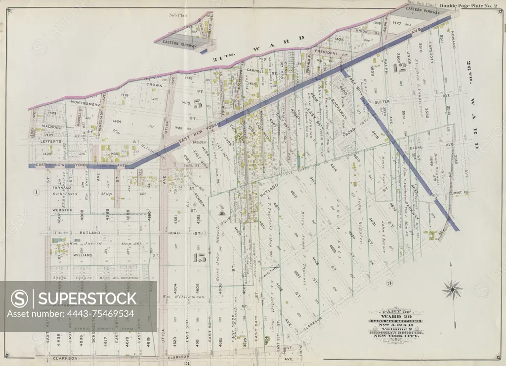
SuperStock offers millions of photos, videos, and stock assets to creatives around the world. This image of Double Page Plate No. 2, issued in 1898 by E.B. Hyde & Co., presents a detailed land map of a section in Brooklyn, New York City. The map is bounded by Montgomery Street, Utica Avenue, Crown Street, Ford Street, East New York Avenue, Howard Avenue, Clarkson Avenue, Remsen Avenue, E. 56th Street, East 45th Street, Troy Avenue, Malbone Street, and Schnectady Avenue. It is part of Ward 29 and includes sections numbered 5, 12, and 15 by Artokoloro is available for licensing today.
Looking for a license?
Click here, and we'll help you find it! Questions? Just ask!
Click here, and we'll help you find it! Questions? Just ask!
DETAILS
Image Number: 4443-75469534Rights ManagedCredit Line:Artokoloro/SuperStockCollection:Artokoloro Model Release:NoProperty Release:NoResolution:5833×4226