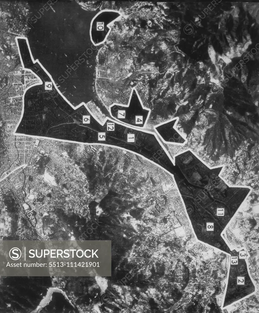
Diagram Of Nagasaki Damage -- Shaded sections on this pre-strike aerial picture of Nagasaki, Japan, represent atomic bomb-damaged areas assessed by army air forces after August 9 Raid. Legend: 1-Mitsubishi Steel and Iron Works, probably 100 per cent destroyed: 2-Ordnance plant, 30-70%: 3-branch gas works, 90%: 4-Mitsubishi woodworking plant, 100%: 5-Kyushu gas works, 50%: 6-Nagasaki rail station and freight yards, 20%: 7-steam power plant, 90%: 8-prison, probably 100%: 9-Dejima wharves, 25%; 10-
SuperStock offers millions of photos, videos, and stock assets to creatives around the world. This image of Explore the Strategic Aerial Map of Hiroshima: A Deep Dive into Historical Geographical Planning and Development. by AP Wirephoto/Sydney Morning Herald is available for licensing today.
Looking for a license?
Click here, and we'll help you find it! Questions? Just ask!
Click here, and we'll help you find it! Questions? Just ask!
DETAILS
Image Number: 5513-111421901Rights ManagedCredit Line:AP Wirephoto/Sydney Morning Herald/SuperStockCollection: