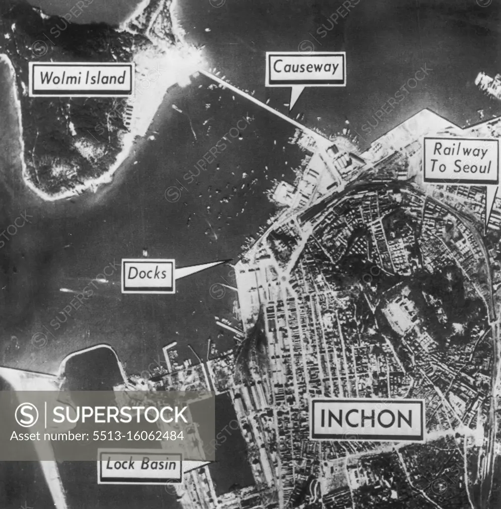
Diagram of Inchon Invasion Area - Aerial photo-diagram shows allied invasion area of Inchon and Wolmi Island on west coast of South Korea. The Island is connected to the city by a causeway. The city's port facilities are back in operation and in use by allied forces. Invasion forces quickly pushed through Inchon against light North Korean opposition and today were fighting in suburbs of Seoul--Red-held South Korean capital--22 miles inland. September 16, 1950. (Photo by AP Wirephoto).
SuperStock offers millions of photos, videos, and stock assets to creatives around the world. This image of Aerial View of Inchon: Strategic Map Highlighting Key Locations Like Wolmi Island, Causeway, and Seoul Railway Access, Ideal for Historical Military Analysis. by AP Wirephoto/Sydney Morning Herald is available for licensing today.
DETAILS
Image Number: 5513-16062484Rights ManagedCredit Line:AP Wirephoto/Sydney Morning Herald/SuperStockCollection: