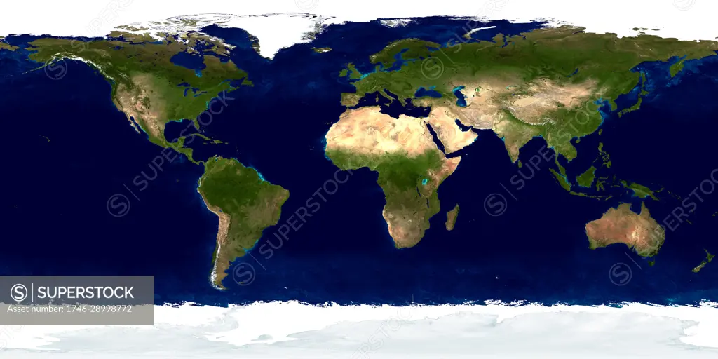
detailed true-colour image of the entire Earth. Using a collection of satellite-based observations, scientists and visualizers stitched together months of observations of the land surface, oceans, sea ice, and clouds into a seamless, true-colour mosaic of every square kilometre (.386 square mile) of our planet. These images are freely available to educators, scientists, museums, and the public. Much of the information contained in this image came from a single remote-sensing device-NASAs Moderate Resolution Imaging Spectroradiometer, or MODIS.
SuperStock offers millions of photos, videos, and stock assets to creatives around the world. This image of detailed true-colour image of the entire Earth. Using a collection of satellite-based observations, scientists and visualizers stitched together months of observations of the land surface, oceans, sea ice, and clouds into a seamless, true-colour mosaic of every square kilometre (.386 square mile) of our planet. These images are freely available to educators, scientists, museums, and the public. Much of the information contained in this image came from a single remote-sensing device-NASAs Moderate Resolution Imaging Spectroradiometer, or MODIS. by Image Asset Management/World History Archive is available for licensing today.
Looking for a license?
Click here, and we'll help you find it! Questions? Just ask!
Click here, and we'll help you find it! Questions? Just ask!
DETAILS
Image Number: 1746-28998772Rights ManagedCredit Line:Image Asset Management/World History Archive/SuperStockCollection:Image Asset Management Model Release:NoProperty Release:NoResolution:6476×3238