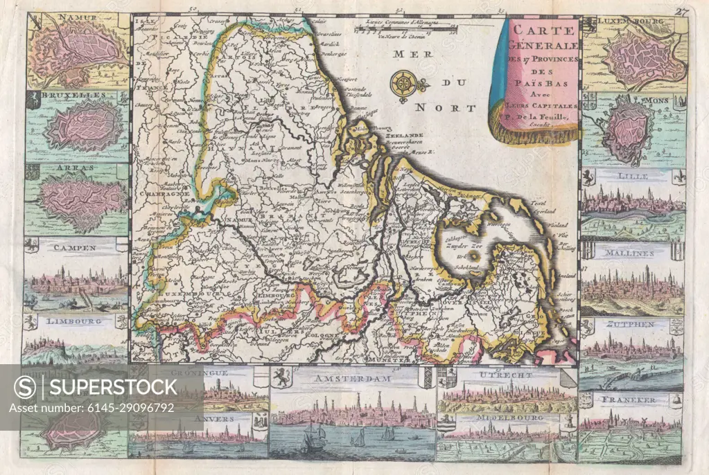
1710 De La Feuille Map of the Netherlands, Belgium and Luxembourg
SuperStock offers millions of photos, videos, and stock assets to creatives around the world. This image of Explore a Historic Map of Friesland: Discover Art and Cartography from the 18th Century Dutch Region by Piemags/PL Photography Limited is available for licensing today.
Looking for a license?
Click here, and we'll help you find it! Questions? Just ask!
Click here, and we'll help you find it! Questions? Just ask!
DETAILS
Image Number: 6145-29096792Royalty FreeCredit Line:Piemags/PL Photography Limited/SuperStockCollection:PL Photography Limited Contributor:Piemags Model Release:NoProperty Release:NoResolution:3212×2153