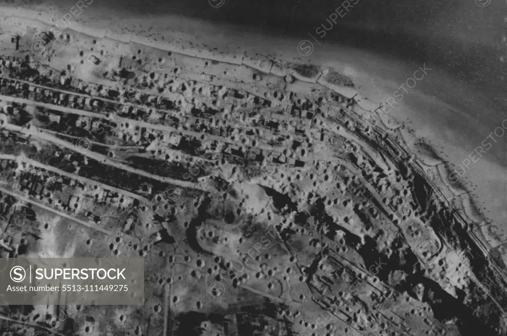
Damage To Le Havre Area This picture in Le Havre area between 9.9.44. and 11.9.44, including the daylight attacks by R.A.F. Bomber Command shows the damage to the gun positions. It was taken by a Photographic Reconnaissance unit aircraft under the direction of R. A.F. Coastal Command. November 13, 1944. (Photo by British Official Photograph).
SuperStock offers millions of photos, videos, and stock assets to creatives around the world. This image of Aerial View of Normandy Beaches Post-D-Day: Historic WWII Landscape with Bomb Craters Along the Coastline. by British Official Photograph/Sydney Morning Herald is available for licensing today.
Looking for a license?
Click here, and we'll help you find it! Questions? Just ask!
Click here, and we'll help you find it! Questions? Just ask!
DETAILS
Image Number: 5513-111449275Rights ManagedCredit Line:British Official Photograph/Sydney Morning Herald/SuperStockCollection:Sydney Morning Herald Contributor:British Official Photograph / Sydney Morning Herald Model Release:NoProperty Release:NoResolution:1765×1171