1769 Cook Map of Tahiti, the Society Islands, and the Vicinity
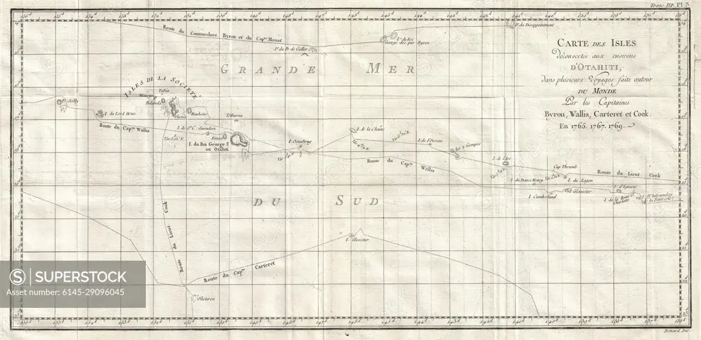
SuperStock offers millions of photos, videos, and stock assets to creatives around the world. This image of Explore Historical Cartography: Vintage Map of Pacific Ocean Islands from the 18th Century – A Glimpse into Nautical Navigation and Exploration History. by Piemags/PL Photography Limited is available for licensing today.
DETAILS
Image Number: 6145-29096045Royalty FreeCredit Line:Piemags/PL Photography Limited/SuperStockCollection: