1777 Cook Map of the Friendly Islands or Tonga
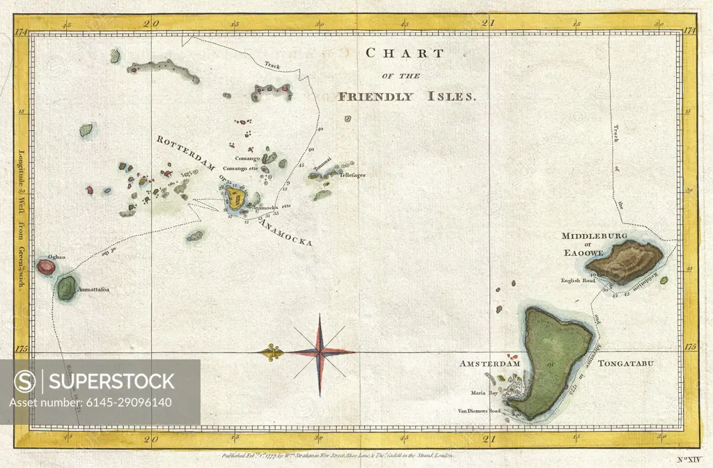
SuperStock offers millions of photos, videos, and stock assets to creatives around the world. This image of Explore the Historic Chart of the Friendly Isles: An Intriguing 18th-Century Map of the Pacific Islands by Piemags/PL Photography Limited is available for licensing today.
DETAILS
Image Number: 6145-29096140Royalty FreeCredit Line:Piemags/PL Photography Limited/SuperStockCollection: