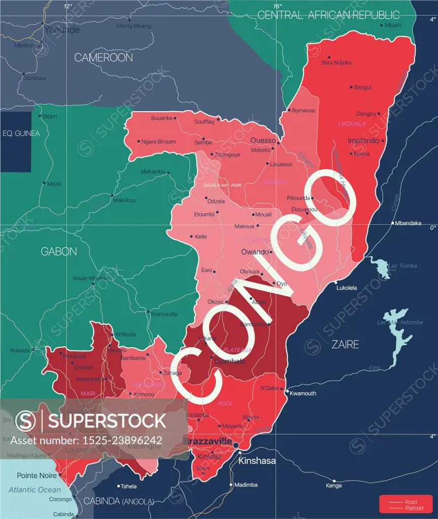
Congo country detailed editable map with regions cities and towns, roads and railways, geographic sites. Vector EPS-10 file. Congo country detailed editable map
SuperStock offers millions of photos, videos, and stock assets to creatives around the world. This image of Congo country detailed editable map with regions cities and towns, roads and railways, geographic sites. Vector EPS-10 file. Congo country detailed editable map by Ingram Publishing is available for licensing today.
Looking for a license?
Click here, and we'll help you find it! Questions? Just ask!
Click here, and we'll help you find it! Questions? Just ask!
DETAILS
Image Number: 1525-23896242Royalty FreeCredit Line:Ingram Publishing/SuperStockCollection:Ingram Publishing Model Release:NoProperty Release:NoType:Vector Image