Comparative time of day map of the United States, issued in 1880. The map measures 21 x 43 cm, with a sheet size of 34 x 54 cm. Published in New York, N.Y., by an unidentified publisher. The subject focuses on time, systems, and standards within the United States
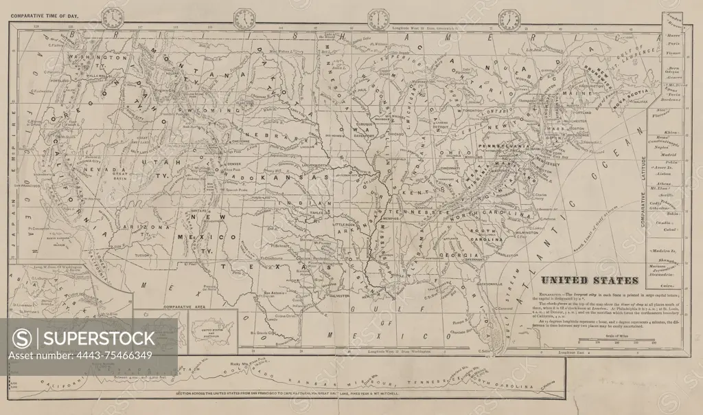
SuperStock offers millions of photos, videos, and stock assets to creatives around the world. This image of Comparative time of day map of the United States, issued in 1880. The map measures 21 x 43 cm, with a sheet size of 34 x 54 cm. Published in New York, N.Y., by an unidentified publisher. The subject focuses on time, systems, and standards within the United States by Artokoloro is available for licensing today.
Looking for a license?
Click here, and we'll help you find it! Questions? Just ask!
Click here, and we'll help you find it! Questions? Just ask!
DETAILS
Image Number: 4443-75466349Rights ManagedCredit Line:Artokoloro/SuperStockCollection:Artokoloro Model Release:NoProperty Release:NoResolution:5700×3366