Colton's road map of the counties of Putnam & Dutchess, New York, 1895. Published by G.W. & C.B. Colton & Co., this map features detailed roads and railroads in both counties. The map measures 63 x 32 cm on a sheet of 70 x 38 cm. It was issued in 1895 and is based in New York
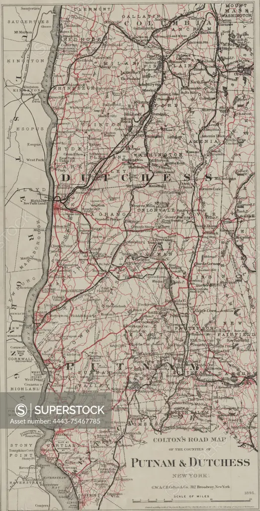
SuperStock offers millions of photos, videos, and stock assets to creatives around the world. This image of Colton's road map of the counties of Putnam & Dutchess, New York, 1895. Published by G.W. & C.B. Colton & Co., this map features detailed roads and railroads in both counties. The map measures 63 x 32 cm on a sheet of 70 x 38 cm. It was issued in 1895 and is based in New York by Artokoloro is available for licensing today.
Looking for a license?
Click here, and we'll help you find it! Questions? Just ask!
Click here, and we'll help you find it! Questions? Just ask!
DETAILS
Image Number: 4443-75467785Rights ManagedCredit Line:Artokoloro/SuperStockCollection:Artokoloro Model Release:NoProperty Release:NoResolution:2906×5700