Colton's new topographical map of the eastern portion of the State of North Carolina with part of Virginia & South Carolina from the latest & best authorities. Covers North Carolina east of Hillsboro. Shows cities and towns, railroads, plank roads, principal roads, canals, forts, and natural features. Prime meridians: Greenwich and Washington. Includes ancillary map, oriented with north to the right: Plan of the sea coast from Virginia to Florida. (12 x 62 cm.). "Entered according to act of Congress in the year 1861 by J.H. Colton in the ... Southern District of New York." Top left margin: No. 11. Decorative border.... , North Carolina
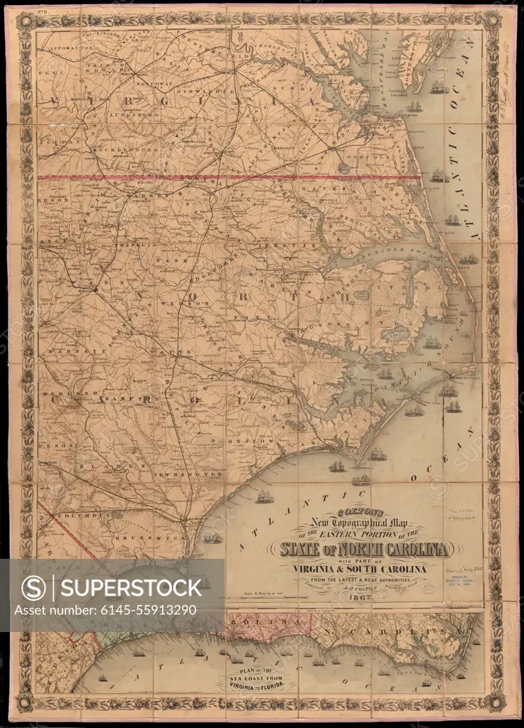
SuperStock offers millions of photos, videos, and stock assets to creatives around the world. This image of Colton's new topographical map of the eastern portion of the State of North Carolina with part of Virginia & South Carolina from the latest & best authorities. Covers North Carolina east of Hillsboro. Shows cities and towns, railroads, plank roads, principal roads, canals, forts, and natural features. Prime meridians: Greenwich and Washington. Includes ancillary map, oriented with north to the right: Plan of the sea coast from Virginia to Florida. (12 x 62 cm.). "Entered according to act of Congress in the year 1861 by J.H. Colton in the ... Southern District of New York." Top left margin: No. 11. Decorative border.... , North Carolina by Piemags/PL Photography Limited is available for licensing today.
Looking for a license?
Click here, and we'll help you find it! Questions? Just ask!
Click here, and we'll help you find it! Questions? Just ask!
DETAILS
Image Number: 6145-55913290Royalty FreeCredit Line:Piemags/PL Photography Limited/SuperStockCollection:PL Photography Limited Story:19th Century U.S. MapsContributor:Piemags Model Release:NoProperty Release:NoResolution:7544×10472