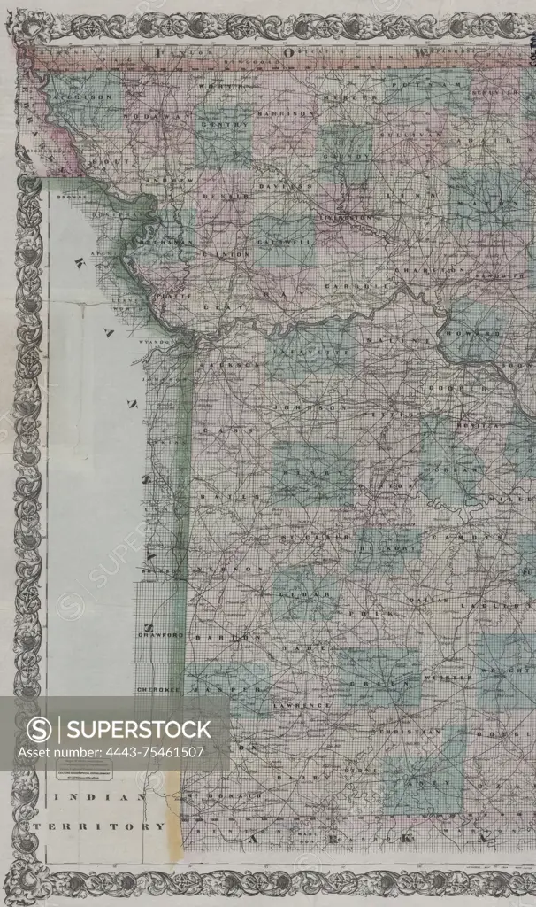
Colton's new sectional map of the state of Missouri, compiled from the United States surveys and other authentic sources, exhibits sections, fractional sections, counties, cities, towns, villages, post offices, railroads, and other internal improvements. The map was published in 1870 by G.W. and C.B. Colton & Co. in New York. It measures 79 x 95 cm (on sheet 86 x 101 cm), is hand-colored, and is folded in a cover measuring 16 x 10 cm. The NYPL Map Division copy is divided into two sheets measuring 86 x 51 cm or smaller, filed flat, and encased in mylar with the original cover. The text includes 'New sectional map of Missouri' and 'Colton's sectional map of Missouri.'
SuperStock offers millions of photos, videos, and stock assets to creatives around the world. This image of Colton's new sectional map of the state of Missouri, compiled from the United States surveys and other authentic sources, exhibits sections, fractional sections, counties, cities, towns, villages, post offices, railroads, and other internal improvements. The map was published in 1870 by G.W. and C.B. Colton & Co. in New York. It measures 79 x 95 cm (on sheet 86 x 101 cm), is hand-colored, and is folded in a cover measuring 16 x 10 cm. The NYPL Map Division copy is divided into two sheets measuring 86 x 51 cm or smaller, filed flat, and encased in mylar with the original cover. The text includes 'New sectional map of Missouri' and 'Colton's sectional map of Missouri.' by Artokoloro is available for licensing today.
Looking for a license?
Click here, and we'll help you find it! Questions? Just ask!
Click here, and we'll help you find it! Questions? Just ask!
DETAILS
Image Number: 4443-75461507Rights ManagedCredit Line:Artokoloro/SuperStockCollection:Artokoloro Model Release:NoProperty Release:NoResolution:3375×5700