Colton's new sectional map of the state of Kansas, compiled from the United States surveys and other authentic sources, dated 1868. This hand-colored map is printed on two sheets, measuring 62 x 114 cm, with individual sheets sized 72 x 63 cm. It is folded and housed in a cover measuring 16 x 10 cm. Published by G.W. & C.B. Colton & Co. in New York
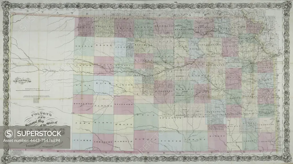
SuperStock offers millions of photos, videos, and stock assets to creatives around the world. This image of Colton's new sectional map of the state of Kansas, compiled from the United States surveys and other authentic sources, dated 1868. This hand-colored map is printed on two sheets, measuring 62 x 114 cm, with individual sheets sized 72 x 63 cm. It is folded and housed in a cover measuring 16 x 10 cm. Published by G.W. & C.B. Colton & Co. in New York by Artokoloro is available for licensing today.
Looking for a license?
Click here, and we'll help you find it! Questions? Just ask!
Click here, and we'll help you find it! Questions? Just ask!
DETAILS
Image Number: 4443-75476894Rights ManagedCredit Line:Artokoloro/SuperStockCollection:Artokoloro Model Release:NoProperty Release:NoResolution:5700×3194