Colton's new railroad and county map of the United States and Canada, issued in 1863 by J.H. Colton. The hand-colored map measures 78 x 96 cm, mounted on an 86 x 101 cm sheet. It features railroads and highlights the administrative and political divisions across the United States, as well as regions in Ontario and Québec. The map was published at 172 William St., New York
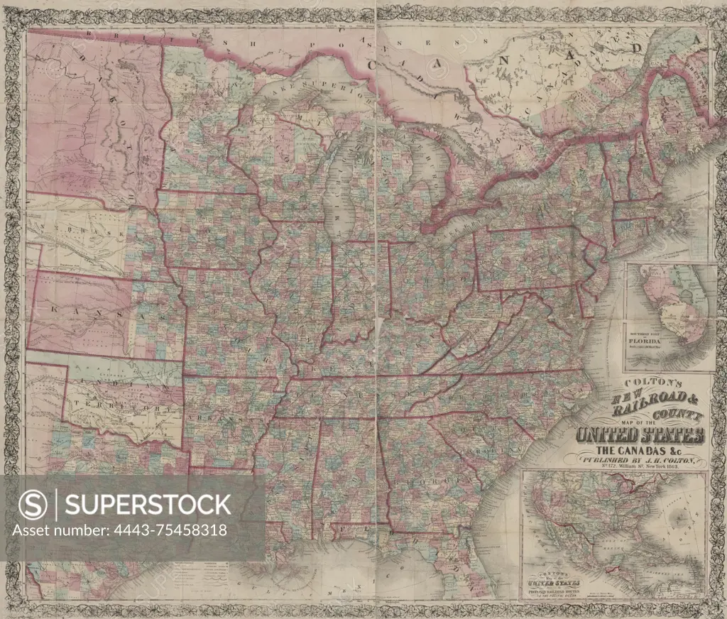
SuperStock offers millions of photos, videos, and stock assets to creatives around the world. This image of Colton's new railroad and county map of the United States and Canada, issued in 1863 by J.H. Colton. The hand-colored map measures 78 x 96 cm, mounted on an 86 x 101 cm sheet. It features railroads and highlights the administrative and political divisions across the United States, as well as regions in Ontario and Québec. The map was published at 172 William St., New York by Artokoloro is available for licensing today.
Looking for a license?
Click here, and we'll help you find it! Questions? Just ask!
Click here, and we'll help you find it! Questions? Just ask!
DETAILS
Image Number: 4443-75458318Rights ManagedCredit Line:Artokoloro/SuperStockCollection:Artokoloro Model Release:NoProperty Release:NoResolution:5700×4855