Colton's map of the county of Westchester, 1877. Publisher, G.W. & C.B. Colton & Co., New York. The map features administrative and political divisions of Westchester County, New York. It is hand-colored and measures 59 x 41 cm, with a sheet size of 61 x 49 cm. The map is designed to be folded in a cover measuring 15 x 10 cm
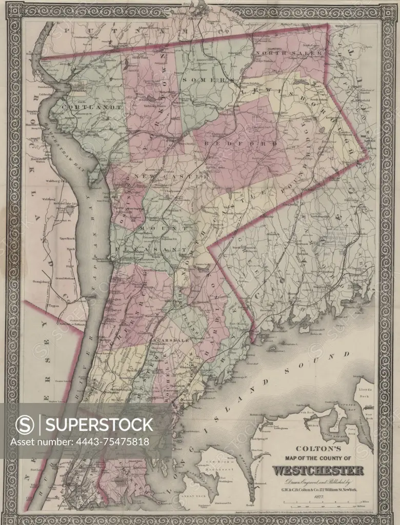
SuperStock offers millions of photos, videos, and stock assets to creatives around the world. This image of Colton's map of the county of Westchester, 1877. Publisher, G.W. & C.B. Colton & Co., New York. The map features administrative and political divisions of Westchester County, New York. It is hand-colored and measures 59 x 41 cm, with a sheet size of 61 x 49 cm. The map is designed to be folded in a cover measuring 15 x 10 cm by Artokoloro is available for licensing today.
Looking for a license?
Click here, and we'll help you find it! Questions? Just ask!
Click here, and we'll help you find it! Questions? Just ask!
DETAILS
Image Number: 4443-75475818Rights ManagedCredit Line:Artokoloro/SuperStockCollection:Artokoloro Model Release:NoProperty Release:NoResolution:4344×5700