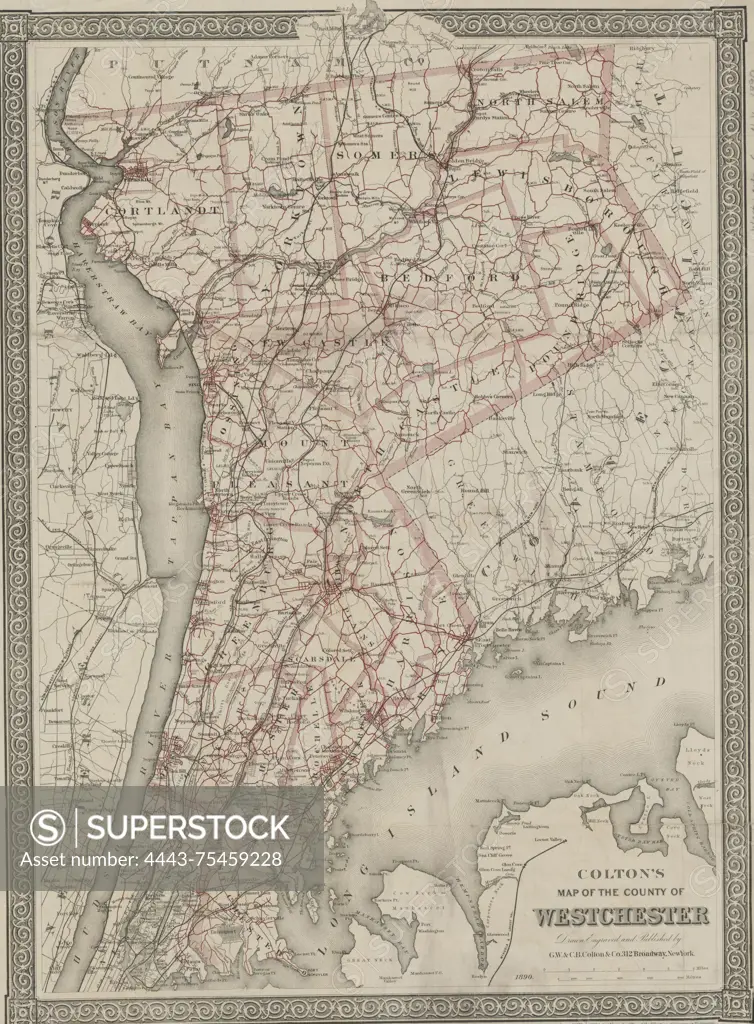
Colton's map of the county of Westchester, 1890, G.W. & C.B. Colton & Co. Additional, Map of the county of Westchester., 1890., New York. Publisher, G.W. & C.B. Colton & Co. Features include roads, aqueducts, and railroads in Westchester County, New York., 1 map (color); dimensions 60 x 41 cm, on sheet 63 x 48 cm
SuperStock offers millions of photos, videos, and stock assets to creatives around the world. This image of Colton's map of the county of Westchester, 1890, G.W. & C.B. Colton & Co. Additional, Map of the county of Westchester., 1890., New York. Publisher, G.W. & C.B. Colton & Co. Features include roads, aqueducts, and railroads in Westchester County, New York., 1 map (color); dimensions 60 x 41 cm, on sheet 63 x 48 cm by Artokoloro is available for licensing today.
Looking for a license?
Click here, and we'll help you find it! Questions? Just ask!
Click here, and we'll help you find it! Questions? Just ask!
DETAILS
Image Number: 4443-75459228Rights ManagedCredit Line:Artokoloro/SuperStockCollection:Artokoloro Model Release:NoProperty Release:NoResolution:4202×5700