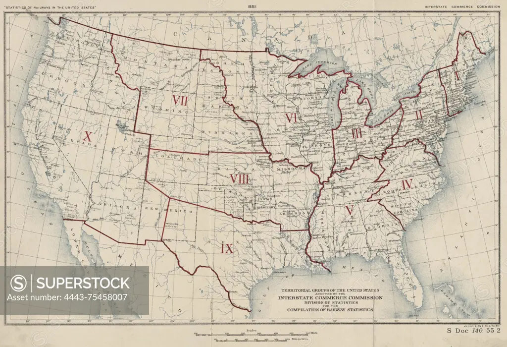
A colored map depicting the territorial groups of the United States as adopted by the Interstate Commerce Commission Division of Statistics for the compilation of railway statistics. The map was issued in 1895 and shows the administrative and political divisions related to railroads. It measures 19 x 30 cm and was published in Washington, D.C. by the Interstate Commerce Commission and lithographed by Julius Bien & Co
SuperStock offers millions of photos, videos, and stock assets to creatives around the world. This image of A colored map depicting the territorial groups of the United States as adopted by the Interstate Commerce Commission Division of Statistics for the compilation of railway statistics. The map was issued in 1895 and shows the administrative and political divisions related to railroads. It measures 19 x 30 cm and was published in Washington, D.C. by the Interstate Commerce Commission and lithographed by Julius Bien & Co by Artokoloro is available for licensing today.
Looking for a license?
Click here, and we'll help you find it! Questions? Just ask!
Click here, and we'll help you find it! Questions? Just ask!
DETAILS
Image Number: 4443-75458007Rights ManagedCredit Line:Artokoloro/SuperStockCollection:Artokoloro Model Release:NoProperty Release:NoResolution:5700×3902