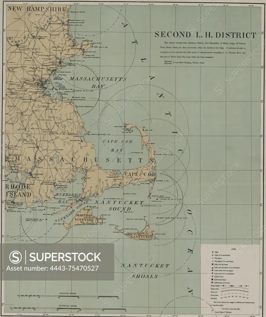
A color map of the Second Lighthouse District, published in 1898 by the U.S. Light-House Board. The map measures 47 x 40 cm, with a sheet size of 53 x 46 cm. It includes geographical features related to lighthouses in the United States, specifically in Massachusetts, and highlights areas such as Nantucket Sound, Cape Cod Bay, Massachusetts Bay, and Buzzards Bay. Additionally, there is a manuscript notation reading 'U.S. Light House Rept. 1898' in lead on the verso, along with a printed numeral '2'
SuperStock offers millions of photos, videos, and stock assets to creatives around the world. This image of A color map of the Second Lighthouse District, published in 1898 by the U.S. Light-House Board. The map measures 47 x 40 cm, with a sheet size of 53 x 46 cm. It includes geographical features related to lighthouses in the United States, specifically in Massachusetts, and highlights areas such as Nantucket Sound, Cape Cod Bay, Massachusetts Bay, and Buzzards Bay. Additionally, there is a manuscript notation reading 'U.S. Light House Rept. 1898' in lead on the verso, along with a printed numeral '2' by Artokoloro is available for licensing today.
Looking for a license?
Click here, and we'll help you find it! Questions? Just ask!
Click here, and we'll help you find it! Questions? Just ask!
DETAILS
Image Number: 4443-75470527Rights ManagedCredit Line:Artokoloro/SuperStockCollection:Artokoloro Model Release:NoProperty Release:NoResolution:4796×5700