A color map of North Dakota published by Rand McNally & Co. in 1892. The map includes details of railroads, administrative and political divisions. It measures 35 x 56 cm and is presented on a sheet that is 39 x 61 cm. The map is attributed to Rand McNally and Company, and was published in Chicago
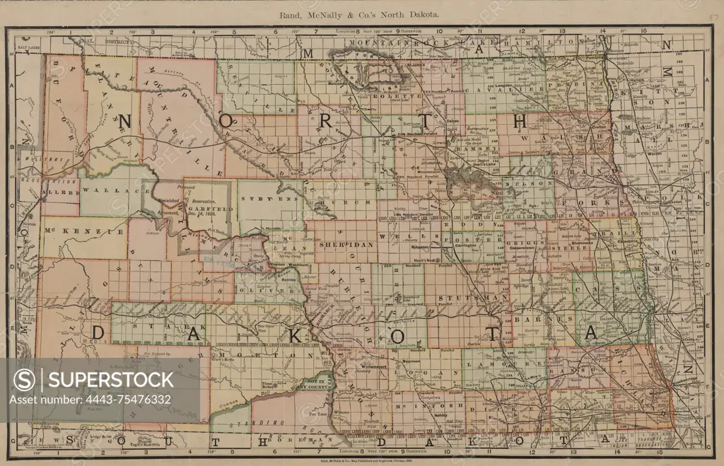
SuperStock offers millions of photos, videos, and stock assets to creatives around the world. This image of A color map of North Dakota published by Rand McNally & Co. in 1892. The map includes details of railroads, administrative and political divisions. It measures 35 x 56 cm and is presented on a sheet that is 39 x 61 cm. The map is attributed to Rand McNally and Company, and was published in Chicago by Artokoloro is available for licensing today.
Looking for a license?
Click here, and we'll help you find it! Questions? Just ask!
Click here, and we'll help you find it! Questions? Just ask!
DETAILS
Image Number: 4443-75476332Rights ManagedCredit Line:Artokoloro/SuperStockCollection:Artokoloro Model Release:NoProperty Release:NoResolution:5700×3671