CODEX TRUJILLO DEL PERU - VOLUME I - MAP OF CAXAMARGUILLA - WATERCOLOR - 18TH CENTURY. Author: MARTINEZ COMPAÑON BALTASAR. Location: PALACIO REAL-BIBLIOTECA. MADRID. SPAIN.
This asset has restrictions and cannot be purchased online. Get in touch for more details.
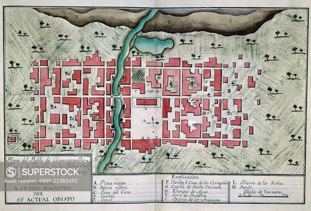
SuperStock offers millions of photos, videos, and stock assets to creatives around the world. This image of Explore Historic Cartography: Detailed 18th Century Map of Guaxacuatzinco Showcasing Colonial Urban Design and Geography by Album/AFO/Album Archivo is available for licensing today.
Looking for a license?
Click here, and we'll help you find it! Questions? Just ask!
Click here, and we'll help you find it! Questions? Just ask!
DETAILS
Image Number: 4409-21382692Rights ManagedCredit Line:Album/AFO/Album Archivo/SuperStockCollection:Album Archivo Contributor:Album / AFO Model Release:NoProperty Release:NoResolution:6259×4255