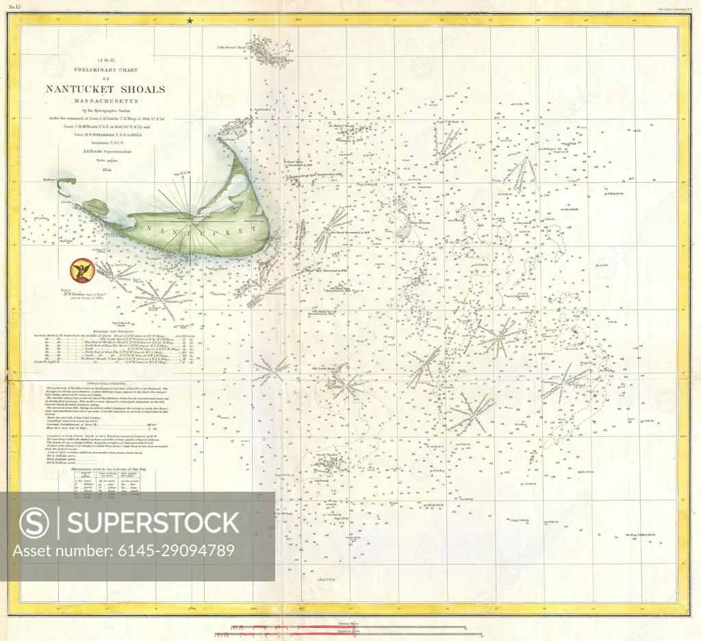
1854 U.S. Coast Survey Nautical Chart or Map of Nantucket, Massachusetts
SuperStock offers millions of photos, videos, and stock assets to creatives around the world. This image of Explore the Historic Nantucket Shoals with this Detailed 1850 Navigation Map – A Glimpse into Maritime History and Coastal Navigation. by Piemags/PL Photography Limited is available for licensing today.
Looking for a license?
Click here, and we'll help you find it! Questions? Just ask!
Click here, and we'll help you find it! Questions? Just ask!
DETAILS
Image Number: 6145-29094789Royalty FreeCredit Line:Piemags/PL Photography Limited/SuperStockCollection: